Tuesday, September 30, 2014

Shoreline Lake


Trail length:  2 miles of trails. Can extend for several miles on the Bay Trail
Trail surface: Paved, and dirt
Trail ratings: Easy
Trail usage: Hikers, bicyclist, and wheelchairs

 Shoreline Lake, located off Hwy 101 in Mountain View, has become one of my favorite places to visit. There are a few accessible trails to enjoy, and most of them are flat. Being an avid bird watcher and photographer, Shoreline is also a wildlife sanctuary to many species of migratory birds.

You also can enjoy the tranquil lake scene, and during the year, you can rent pedal boats, rowboats, canoes, kayaks, windsurfers, and sailboats. For a longer wheelchair hike, the Bay Trail runs next to it. This paved trail will take you to the Baylands Nature Preserve, another great bird watching area.

Lakeside Cafe, which is located next to the lake, offers a place to eat, accessible bathrooms, and handicap parking. It’s where we usually park. You can also access the other side of the lake by taking San Antonio Road, and there is a handicap parking spot at the far end of the parking lot. Because Shoreline Lake is so popular, it will sometime be crowded on the weekends.

For wheelchair users, this is a wonderful place to visit.


To see more of Shoreline Lake and its trails, 
please watch my video.


Sunday, June 29, 2014

Horseshoe Lake - Skyline Ridge Open Space Preserve

Trail length:  .3 miles
Trail surface: Hard packed dirt
Trail ratings: Easy
Trail usage: Hikers, and wheelchairs


I enjoyed this short, but scenic, wheelchair-accessible trail which skirts along the lake. The dirt trail though was rough going at times and could use some maintenance. The end of the trail connects to the Ridge Trail, which crosses over a bridge. After crossing it, you’ll be rewarded with a panoramic view of Horseshoe Lake. The trail continues on to a trail junction. The trail to the left is the Horseshoe Loop Trail, the one on the right is the Tree Farm Trail.

I found the first part of the Horseshoe Loop Trail to be much smoother and enjoyable than the wheelchair-accessible trail. Eventually, the trail leads to a small, steep hill which will be challenging for manual wheelchairs. The trail continues on, and after crossing a bridge, it becomes more narrow and you’ll need to wheel past overgrowth as the trail becomes steeper. Finally, you’ll make it to the top where you’ll have a wonderful view of the lake. It is a very precarious spot though, and I found myself inches away from the drop-off. As much as I was elated to finally make it up to this view of the lake, it was too risky at parts of the trail for me to consider to make a return trip, or even to recommend.

The Tree Farm Trail, though very wide, is a very steep trail with rocks and tree roots ready to slam into your wheels. Even with my power chair, I found it very difficult to navigate. Coming back down was even more challenging and a couple of times my wheels skidded out of control.

Throughout the morning, I saw several deer, lots of birds, and a snake sunbathing on a trail. There is plenty of parking and an accessible bathroom.
Weather can change quickly. When I first got there, there was a heavy mist hanging over the area. An hour later though, the sun finally broke through, so come prepared.

I would rate Horseshoe Lake 3 out of 5 stars. The wheelchair-accessible trail is bumpy, but the tradeoff is the beauty of the lake and area. It would be a nice place to have a short hike and a picnic.

Skyline Ridge Open Space Preserve, is located on Skyline Boulevard (CA 35).

 To see more of Horseshoe Lake,
please watch my video.

Tuesday, April 8, 2014

Baylands Nature Preserve - 2014

The Baylands Nature Preserve is 1,940 acres of undisturbed marshland, with miles of multi-use trails woven in and around it. It is one of the best areas for bird watching on the West Coast.

There are three main ways to enter the Preserve. First is from the Embarcadero Road, which will lead you to the Lucy Evans Baylands Nature Interpretive Center.  This dirt trail offers a close-up view of various bird species.  It’s one of my favorite places for bird watching and for bird photography.  There is also the Duck Pond, but I have only been there a couple of times, mainly because of all the duck poop on the ground.

If you take a right turn at the stop sign, right before entering the Preserve, the road will lead you to Byxbee Park.  There is one handicap parking space and an accessible bathroom.  If you enjoy a long hike, this is a great place to start from.  You’ll hike past the Mayfield Slough and then eventually see the Charleston Slough.

The third way to enter Baylands Nature Preserve is by taking San Antonio Road.  There are a couple of handicap parking spots available and an accessible bathroom.  What I like about this entrance is that, not only can you hike along the miles of trails, but you have Adobe Creek on the left of the trail, which is a great place to see the American White Pelican.  To the right of the trail, you have a viewing platform that gives you a view of the Charleston Slough.  The bonus of parking here is that to the right of the parking area is one of the entrances to Shoreline Lake.  Another wonderful place for bird watching.

Most of the trails are flat and are made up of hard-packed dirt. The only drawback is that you’ll accumulate a lot of trail dust.

Overall, this is a wonderful place to hike and to enjoy seeing many various types of bird species.

To see more of Baylands Nature Preserve
please watch my video

Sunday, September 8, 2013

Sawyer Camp Trail

Located in San Mateo County, the Sawyer Camp Trail runs above the Crystal Springs Reservoir. The trail is mostly flat and marked for two-way traffic and it has mile markers every half -mile. There are two handicap parking spots and there is an accessible bathroom at the beginning of the trail and another one a couple of miles further down.

There are no water fountains on the trail, so bring your own water. There are also benches located at different spots along the trail, most of them giving you a panoramic view of the reservoir.

The trail is multi-use ... joggers, cyclists, parents with strollers, and is wheelchair accessible. Because this trail is so popular, during the weekends the trail can be very crowded and you have to keep aware of cyclists that at times can come zipping by.

Weather can be tricky. Fog at times comes over the mountains and the trail can be cast in a light mist, so plan ahead with extra clothing, just in case.

Overall, I really enjoyed cruising along this beautiful trail, but the best time to enjoy this trail is on a weekday so that you can avoid the crowds.


To see more of the Sawyer Camp Trail,
please watch my video.

Sunday, April 28, 2013

San Bruno Mountain State Park

San Bruno Mountain State Park has several hiking trails including a wheelchair-accessible trail - Bog Trail. As I traveled along this trail, though, I could see that it was no longer accessible. It became too narrow and I got stuck a couple of times and I eventually had to turn around and go back.

Old Guadalupe Trail is a wide, paved trail. The reason it isn't labeled an accessible trail, though, is because it goes uphill for about 0.4 miles and doesn't meet the ADA trail guidelines. However, in a power chair this is trail is fine, but for someone in a manual wheelchair, it could be quite the workout.

I also did a hike on Saddle Loop Trail. This is a 2.9-mile trail that winds around part of the mountain and has a great view of San Francisco. This trail, though, is a rough, dirt trail and traveling along it in my power chair became very bumpy at times. Power chairs with small wheels could have trouble in some places and I wouldn't recommend a person in a manual wheelchair to hike it.

I have informed the San Mateo Park Department that Bog Trail is no longer accessible. They replied to let me know that because of budget issues, they aren't able to fix the Bog Trail at this time. Bummer!


To see more of San Bruno Mountain State Park,
please watch my video.

Sunday, February 17, 2013

Capitola By the Sea - 2013

Capitola is one of my favorite places to visit.  It is easy to get around in a wheelchair.   During the summer, a wheelchair-accessible walkway is built and it juts out onto the beach.  Most of the restaurants have wheelchair access, and Mr. Toots Coffee House has a specially-made elevator for wheelchair access.

It can get crowded, especially during the summer months, so I've always had tried to go there in the morning.

To see more of my tour of Capitola,
please watch my video.


Monday, October 8, 2012

Lighthouse Field State Beach

Lighthouse Field State Beach is home to California's first surfing museum and it overlooks one of the local surfing hot spots - Steamer Lane.

It is one of my favorite places in Santa Cruz to visit because there is a long, paved walkway which stretches along the coastline, giving you a wonderful view of the Pacific Ocean and the beaches below.

You can watch and listen to the seals on Seal Rock, or enjoy watching the surfers as they ride the waves. There are several parking areas near the surfing museum and most of them have at least one handicap parking spot.

To see more of Lighthouse Field State Beach,
please watch my video.


Saturday, August 25, 2012

Purisima Creek Redwoods - Redwood Trail

The Purisima Creek Trail's "Redwood Trail" is located on Skyline Boulevard, 6.5 miles south of Hwy 92.

This 0.6 mile, hardened-dirt trail has a few slight inclines as it winds through the redwoods. There are a couple picnic tables placed along the trail as well as a wheelchair-accessible bathroom. I enjoyed traveling along this, at times, challenging trail and it would be a great place to have lunch after your hike.


For a closer look of the Redwood Trail,
please watch my video.
Friday, July 13, 2012

Big Basin Redwoods State Park

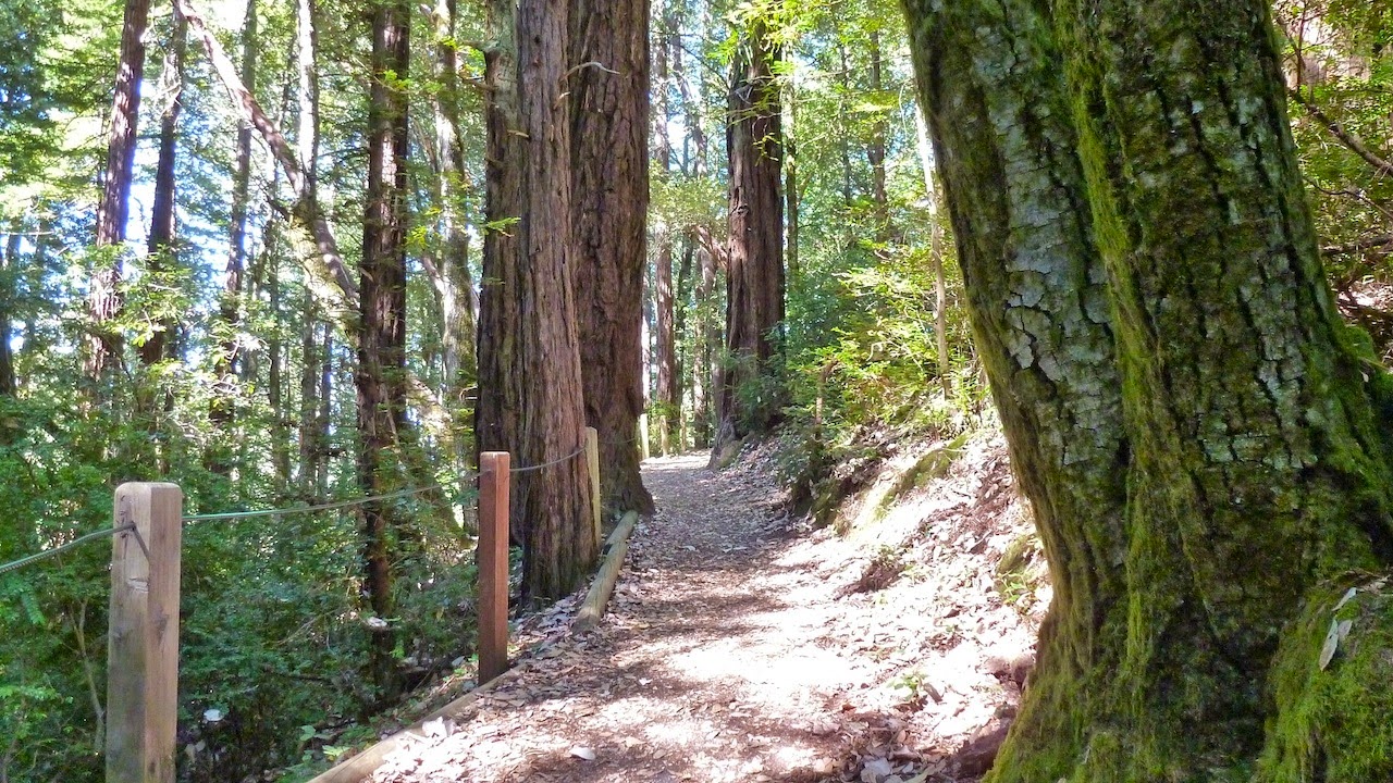
Big Basin Redwoods State Park is located in Boulder Creek, California. The park has two accessible trails. The first one is the Redwood Loop NatureTrail. This 0.63 mile, hard-packed dirt trail is very wide and mostly flat. I found it to be an enjoyable hike through the redwoods.

The other accessible trail is the Skyline to the Sea Trail. This 0.28 mile trail much more challenging. The 4-feet-wide trail has an elevation change of 29 feet. At one part of the trail, a couple hikers had to step off the trail in order for me to pass. That said, there is a bridge that has a wonderful view of the creek below, and you can't help but look up in awe at the ancient forest.

There are accessible bathrooms, picnic tables, camping sites, and the park headquarters is also accessible. The park entrance fee is $10.00. You may use the entrance fee receipt for any other state park you visit that day.


For a closer look of the two accessible trails at Big Basin,
please watch my video.


Sunday, June 10, 2012

Francis Beach - Half Moon Bay

Francis Beach, located in Half Moon Bay, California, has a lot to offer. It has miles of wide, sandy beaches, picnic tables, and a campground with 52 individual sites. Another enjoyable aspect of this place is the 2.4 miles of the "Coastal Trail" which runs along the eastern boundary of this state beach. There is plenty of handicap parking and the bathrooms are accessible. The Coastal Trail is paved and flat. There are also 4 accessible camping sites.

For wheelchair users, Francis Beach has a beach wheelchair. It is free to use for up to 2 hours. It was my first time being in a beach wheelchair and, since this was also the first time since I became disabled that I have been on the beach and close to the crashing waves, it was a very special time.

Weather can be foggy, especially during the summer. It was quite windy when I was there in the spring. So plan on bringing extra warm clothing and checking the weather report ahead of time.


To see more of my tour of Francis Beach,
please watch my video.